In Moncton, we frequently encounter sites where the gentle topography masks underlying geotechnical challenges that only become apparent during excavation or after heavy rainfall. The city's position along the Petitcodiac River, with its notorious tidal bore reshaping banks twice daily, creates slope conditions that demand careful evaluation before any construction begins. Many properties near the river corridor sit on glaciofluvial deposits left by retreating ice sheets roughly twelve thousand years ago, and these materials behave very differently than the bedrock-controlled slopes found elsewhere in New Brunswick. Our team has worked across the city's varied terrain from the flatlands of Dieppe to the rolling drumlins near Magnetic Hill, and we have learned that slope stability here is rarely a textbook scenario. The interaction between silty clay layers, fluctuating groundwater levels, and freeze-thaw cycles that penetrate up to a meter deep in Moncton winters means that a slope stability analysis must account for seasonal variations that static calculations often miss. When slope issues are identified early, they can usually be addressed through straightforward engineering measures rather than costly emergency repairs.
A slope that looks benign in August can become a liability in April, and that seasonal reality drives how we approach every analysis in Moncton's glacially shaped terrain.
Technical details of the service in Moncton
Demonstration video
Critical ground factors in Moncton
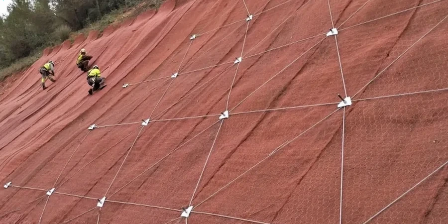
When we mobilize a slope inclinometer and piezometer array on a Moncton site, the first thing we check is whether surface drainage patterns have been altered by nearby construction or road widening projects, because that is where we see the most preventable failures. The equipment itself is straightforward: a grooved casing installed in a borehole, a biaxial probe that measures deflection at half-meter intervals, and dataloggers that track pore-water pressure response to rainfall events. What the data reveals, however, can be sobering. A slope that moves less than five millimeters per year under normal conditions can accelerate to twenty millimeters in a single week if a water main leak goes undetected or if a neighbor regrades their property without considering the downstream consequences. The cost of ignoring these warning signs escalates quickly, from manageable drainage corrections to full-scale retaining structures or soil nailing systems. In Moncton's regulatory environment, where the city engineering department reviews slope hazard assessments for any development within thirty meters of a watercourse or steep grade, a properly documented analysis is not optional paperwork. It is the difference between a permit issued on schedule and a project stalled for months while geotechnical concerns are resolved retroactively.
Our services
Our slope stability work in Moncton spans three distinct service areas, each tailored to the scale and regulatory requirements of the project. Whether you are a homeowner concerned about a backyard embankment or an engineer designing a commercial subdivision, we structure our deliverables to provide clear, actionable recommendations that meet city permitting standards.
Residential Slope Assessment
For homeowners and builders dealing with sloping lots, erosion along the Petitcodiac corridor, or retaining wall design under four feet of unbalanced fill. Includes site walkover, hand-auger sampling where access permits, stability calculations, and a stamped report suitable for building permit applications.
Commercial and Infrastructure Slope Design
Full-scale analysis for roadway embankments, stormwater management ponds, and multi-unit developments. Incorporates borehole drilling, laboratory shear strength testing, and detailed limit equilibrium modeling with groundwater sensitivity analysis. Deliverables meet Moncton city engineering submission requirements.
Post-Failure Investigation and Remediation
When a slope has already moved, we mobilize instrumentation to define the failure plane geometry and residual strength parameters. Recommendations cover drainage improvements, buttress fills, soil nailing, or anchored retaining systems as appropriate for the site constraints.
Common questions
What does a slope stability analysis cost for a typical residential lot in Moncton?
For a residential slope assessment, our fees typically range from CA$1,660 to CA$6,360 depending on site access, slope height, and whether laboratory testing is required. A straightforward visual assessment with hand calculations falls at the lower end, while a full investigation with borehole drilling, triaxial testing, and detailed computer modeling moves toward the upper range. We provide a fixed-fee proposal after an initial site visit so there are no surprises.
How long does the analysis take from start to finish?
A typical residential slope assessment can be completed within two to three weeks from mobilization to report delivery, assuming reasonable weather for fieldwork. Larger commercial projects with laboratory testing may require four to six weeks, primarily because consolidated-undrained triaxial tests need time for specimen saturation and consolidation. We always coordinate our schedule with your project timeline and can expedite certain stages if permitting deadlines are approaching.
Does the City of Moncton require a slope stability report for building permits?
Yes, the city's engineering department generally requires a geotechnical slope stability assessment for any development within thirty meters of a watercourse or on slopes steeper than fifteen percent. The report must be stamped by a professional engineer licensed in New Brunswick and must demonstrate that the proposed construction will not compromise long-term slope stability or increase risk to adjacent properties.
What is the difference between a factor of safety of 1.3 and 1.5 in your reports?
The factor of safety is the ratio of soil shear strength to the shear stress required for equilibrium. A value of 1.5 is the minimum we target for permanent slopes under static conditions per Canadian geotechnical practice, meaning the soil is fifty percent stronger than it needs to be to just barely stand. A value of 1.3 is sometimes accepted for temporary excavation slopes or for conditions where the consequences of a failure are limited and the analysis uses conservative strength parameters. We always explain which factor applies to your specific situation and why.